Under authority of the act of Congress approved June 4, 1897 (30 Stat. 34-36), and on the recommendation of the Secretary of Agriculture, it is hereby ordered that the tracts of land in Alaska lying within the following-described boundaries, heretofore occupied as home sites or for cannery purposes, be, and the same are hereby, excluded from the Tongass National Forest and restored to entry under the applicable public land laws: Chs. Beginning at Corner No. 1, at the head of a small bight on the line of mean high tide, on the easterly shore of Clover Pass, Kevillagigedo Island, northeast of Survey Point and abreast of Clover Island, in approximate latitude 55° 28.5' N., longitude 131° 47.5' W., which corner is a squared hemlock stake marked HS1; from which A red cedar bears S. 10° E., 0.64 lks. distant, blazed low and marked WHS1. Thence with meanders of mean high tide: (1) N. 17° W., 0.82 chs.; (2) N. 29° E., 1.70 chs.; (3) N. 10° W., 1.15 chs.; (4) N. 45° W., 0.49 chs.; (5) N. 50° W., 1.60 chs.; (6) S. 73° W., 2.39 chs.; (7) N. 57° W., 1.20 chs.; to Corner No. 2, which is a hemlock stake set at mean high tide line in mound of rocks, marked HS2; from which A spruce, 29 in. diam., bears S. 29° E., 95 lks. distant, blazed and marked WHS2. Thence south. 4.00 Corner No. 3, which is a hemlock tree, 10 in. diam., blazed and marked HS3; from which A hemlock, 12 in. diam., bears S. 50° W., 12 lks. distant, blazed and marked WHS3. Thence S. 78° E. 4.50 Corner No. 1, and the place of beginning, containing approximately 1.75 acres. The survey was made August 24, 1927; the bearings of the lines were determined by needle compass, allowing a variation of 31° E., and are intended to refer to the true meridian. Beginning at Corner No; 1, meander corner, on north, side of Port Conclusion, Baranof Island, near its head, at the line of mean high tide, in approximate latitude 56° 14' 30" N., longitude 134° 41' W., which corner is a cross chiseled on a slate cone-shaped rock in place, 20 inches in diameter, 24 inches high, protruding from and a part of a slate ledge, marked XMC1; from which A spruce, 12 in. diam., bears N. 66° W., 78 lks. distant, marked XBT1MC. A spruce, 29 in. diam., bears S. 24° W., 68 lks. distant, marked XBT1MC. Point on south side of entrance to Port Conclusion bears N. 42° E. Thence with meanders along the line of approximate mean high tide: (1) S. 54° 18' E., 0.74 chs.; (2) S. 36° W., 0.87 chs.; (3) S. 16° 40' W., 0.67 chs.; (4) S. 48°40'E., 1.33 chs.; (5) S. 24° W., 0.74 chs.; (6) S. 68° 50' W., 1.48 chs.; (7) N. 73° W., 1.74 chs.; (8) S. 38° 25' W., 2.21 chs.; (9) S. 77° 40' W., 1.17 chs.; (10) S. 42° 15' W., 1.76 chs.; (11) S. 3° 10' E., 1.47 chs.; (12) S. 30° 50' E., 2.25 chs.; (13) S. 12° 50' W., 0.50 chs.; to Corner No. 2, meander corner, a cross chiseled on a slate ledge in place, marked XMC2; from which A hemlock, 8 in. diam., bears N. 50° W., 16 lks. distant, marked XBTMC. A spruce, 16 in. diam., bears S. 71° W., 28 lks. distant, marked XBTMC. Thence west, 3.79 chs. Thence north, 10.53 chs. Thence east, 8.81 chs. To Corner No. 1, meander corner, and the place of beginning. The survey of the meanders of Port Conclusion Bay was made June 3 and 4, 1930. No survey of the last three courses was made, nor were monuments established. The bearings of the Hues refer to the true meridian. The tract contains 5.91 acres. Beginning at Corner No. 1, on line 2-3 of United States Survey No. 8, in approximate latitude 55° 36' N., longitude 131° 38' W., which corner is a hemlock post 6½ feet long, 4½ inches in diameter, squared to 3½ inches, set 3 feet in the ground, marked HS1; from which A hemlock, 14 in. diam., bears S. 82½° E., 21 lks. distant, marked in blaze SHW1. A hemlock, 9 in. diam., bears S. 9° W., 21 lks. distant, marked in blaze WHS1. Thence S. 40° W. along line 2-3 of United States Survey No. 8. 6.10 Witness corner to Corner No. 2, meander corner, identical with witness corner to Corner No. 2 of United States Survey No. 8. 6.45 Point for Corner No. 2, meander corner, identical with Corner No. 2 of United States Survey No. 8, not set because of liability to destruction by tides. Thence with meanders along line of approximate mean high tide: (1) N. 75° 30' W., 0.17 chs.; (2) N. 69° 30' W., 0.26 chs.; (3) N. 83° W., 0.62 chs.; (4) S. 46° W., 0.60 chs.; (5) S. 14° W., 1.60 chs.; (6) S. 40° 30' W., 1.25 chs.; to point for Corner No. 3, meander corner, not set because of liability to destruction by tides. Thence north. 0.60 Witness corner to Corner No. 3, meander corner, which is a cedar post 5½ feet long, 5½ inches in diameter, squared to 4 inches, set 1 foot in the ground in mound of stone, marked HS3WCMC; from which A scrubby spruce, 16 in. diam., bears S. 79° E., 21 lks. distant, marked HSWCMC. 7.61 Corner No. 4, which is a spruce post 5 feet long, 5 inches in diameter squared to 4 inches, set 2 feet in the ground, marked HS4; from which A spruce, 10 in. diam., bears S. 3½° W., 11 lks. distant, marked in blaze WHS4. A hemlock, 12 in. diam., bears N. 53° E., 20 lks. distant, marked in blaze WHS4. Thence east. 6.88 Corner No. 1, and the place of beginning, containing approximately 2.54 acres. The survey was made August 20 and 21, 1930; the bearings of the lines were determined by needle compass, allowing a variation of 30° E., and are intended to refer to the true meridian. HERBERT HOOVER The White House, August 4, 1931.
Executive Order 5673 ⚖️✨ Zone 2: Zone of Twilight Constitutional Neutral (+0.02)
📜 Art. II §1: Executive Discretion & Internal Operations
Executive Order 5673—Tongass National Forest, Alaska
Executive Brief • At a Glance
⏱️ 5 min read (1,026 words) •
● In Effect
🎯 Primary Mandate
The tracts of land in Alaska lying within the following-described boundaries, heretofore occupied as home sites or for cannery purposes, be, and the same are hereby, excluded from the Tongass National Forest and restored to entry under the applicable public land laws: Chs.
⚖️ Constitutional Footing
⚖️✨ Zone 2: Zone of Twilight
Concurrent Authority / Congressional Silence
📜 Art. II §1: Executive Discretion & Internal Operations
🏛️ Scope & Affected Sectors
Private Citizens & Property Owners
Plain-English Translation & Framers' Constitutional Analysis
Early Statesman synthesis distilling legal jargon into practical meaning, statutory anchors, and structural constitutional impacts.
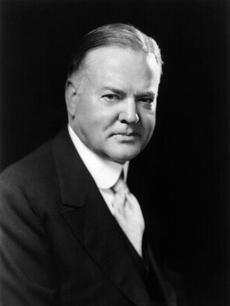
Signed by President Herbert Hoover on August 4, 1931, this order concerns Tongass National Forest, Alaska. The tracts of land in Alaska lying within the following-described boundaries, heretofore occupied as home sites or for cannery purposes, be, and the same are hereby, excluded from the Tongass National Forest and restored to entry under the applicable public land laws: Chs.
Constitutional Assessment: This action represents an orderly exercise of Article II administrative discretion, managing the internal machinery and personnel of the executive branch without abridging the ancient liberties of the people.
Key Directives & Operative Actions
▪
The tracts of land in Alaska lying within the following-described boundaries, heretofore occupied as home sites or for cannery purposes, be, and the same are hereby, excluded from the Tongass National Forest and restored to entry under the applicable public land laws: Chs.
▪
No survey of the last three courses was made, nor were monuments established.
Constitutional & Societal Entities Impacted
🏛️ Private Citizens & Property Owners
Policy Areas & Topics
🏛️
The Framers' Constitutional Council
1787 PrismEvaluating this order against the constitutional debates of 1787 and the limits of Article II executive power.
⚖️✨ Zone 2 (Zone of Twilight)
§
"When the President acts in absence of either a congressional grant or denial of authority, he can only rely upon his own independent powers, but there is a zone of twilight in which he and Congress may have concurrent authority."
— Justice Robert H. Jackson, Youngstown Sheet & Tube Co. v. Sawyer (1952) Concurrent Authority / Congressional Silence
JM
James Madison
Separation of Powers & Legislative Primacy
"Power is of an encroaching nature, and it ought to be effectually restrained from passing the limits assigned to it." — Federalist No. 48 (1788)
Madison would view this order with watchful scrutiny. Operating in the 'Zone of Twilight' where Congress is silent, each such directive establishes an administrative precedent that steadily expands the executive perimeter at the expense of legislative primacy.
Madisonian Stance: Vigilant / Cautionary
AH
Alexander Hamilton
The Energetic Executive & Unified Command
"A feeble Executive implies a feeble execution of the government; and a government ill executed, whatever it may be in theory, must be, in practice, a bad government." — Federalist No. 70 (1788)
Hamilton would view this directive as the natural and indispensable functioning of administrative leadership. Without the power to coordinate agencies, manage personnel, and resolve operational ambiguities, the modern presidency would be reduced to an impotent figurehead.
Hamiltonian Stance: Defends Vigor & Dispatch
GM
George Mason
Bill of Rights, Due Process & 10th Amendment
"The president will be surrounded by flatterers and sycophants... and the great powers of the executive will gradually absorb the liberties of the people." — Cato IV (Anti-Federalist, 1787)
The Anti-Federalist prism advises continuous democratic vigilance. Even routine administrative directives aggregate centralized federal power away from town halls and state assemblies toward a distant executive apparatus.
Anti-Federalist Stance: Eternal Vigilance Required
📐
Five Measurable "Constitutional Friction" Dimensions
An objective audit measuring potential separation-of-powers tension against the United States Constitution and established Supreme Court doctrine.
⚖️ Discretionary Twilight Zone
30 / 100 friction index
Dimension 1 • Art. I, §1 & §8
Low Friction
Legislative Encroachment & Purse
Operates within delegated statutory execution without modifying legislative appropriations or taxing powers.
Benchmark: Power of the purse, taxes/tariffs, and rule of law reserved to Congress.
Dimension 2 • Art. II, §1 & §3
Low Friction
Executive Scope & Faithfulness
Exercises standard supervisory executive authority to faithfully execute existing statutes.
Benchmark: Faithfully execute laws enacted by Congress vs. unilateral decree.
Dimension 3 • 10th Amendment
Moderate Friction
Federalism & State Sovereignty
Engages state and local partners in cooperative federalism programs.
Benchmark: Police powers and un-delegated responsibilities reserved to the States.
Dimension 4 • 5th & 14th Amendments
Low Friction
Due Process & Individual Rights
Focuses on internal governmental operations with no direct impairment of private rights or property.
Benchmark: Protection of private property, contracts, liberty, and procedural justice.
Dimension 5 • Separation of Powers
Moderate Friction
Youngstown Jacksonian Tier
The order relies on inherent Article II executive discretion, civil service management, or foreign diplomacy where Congress has neither expressly approved nor prohibited action.
Benchmark: Concurrent Authority / Congressional Silence
⚖️
Audit Synthesis
This order operates within Justice Jackson’s Zone of Twilight, resting upon concurrent presidential authority or congressional silence.
Weighted composite: Art. I (25%), Art. II (25%), Federalism (15%), Due Process (15%), Youngstown (20%).
ℹ️
How to read these dimensions: Executive power expands whenever an administration acts without explicit statutory authorization from Congress (Article I), touches upon police powers historically reserved to the states (Tenth Amendment), or limits private rights and property without judicial process. A low friction score indicates strict concordance with enacted law; a high friction score highlights orders testing the limits of presidential discretion.
Total Words
1,026
5,428 characters
Estimated Read Time
5 min
@ 200 words / min
Flesch-Kincaid
5.5
Grade 6
Text size:
Related Executive Orders
Other executive actions signed by Herbert Hoover around this period.
EO 5672 Aug 3, 1931
⚖️✨ Zone 2 (Zone of Twilight) Constitutional Neutral
Executive Order 5672—Public Water Reserve No. 143, Colorado and Wyoming
📜 Art. II §1: Executive Discretion & Internal Operations
The land hereinafter listed be, and the same is hereby, withdrawn from settlement, location, sale, or entry and reserved for public use in accordance with the provisions of section 10 of the act of December 29, 1916 (39 Stat. 865): Colorado SIXTH PRINCIPAL MERIDIAN T. 8 N., R.…
 Herbert Hoover
High School • 1m
EO 5676 Aug 7, 1931
⚖️✨ Zone 2 (Zone of Twilight) Constitutional Neutral
Executive Order 5676—Modification of Reservoir-Site Reserve No. 1, Wenatchee Lake Reservoir, Washington
📜 Art. II §1: Executive Discretion & Internal Operations
The Executive order of January 17, 1911, creating Reservoir-Site Reserve No. 1, is hereby modified to the extent of authorizing the Federal Power Commission to issue a license for Project No. 1150 on the following-described lands: Willamette Meridian T. 26 N., R. 17 E., sec. 8…
Herbert Hoover High School • 1m
EO 5675 Aug 7, 1931
⚖️✨ Zone 2 (Zone of Twilight) Constitutional Neutral
Executive Order 5675—Revocation of Withdrawal of Public Lands Pending Resurvey, Utah
📜 Art. II §1: Executive Discretion & Internal Operations
Executive Order No. 4425 of April 19, 1926, withdrawing the public lands in T. 6 S., R. 19 E., Salt Lake meridian, Utah, pending a resurvey, be, and the same is hereby, revoked.
Herbert Hoover College Level • 1m
EO 5674 Aug 7, 1931
⚖️✨ Zone 2 (Zone of Twilight) Constitutional Neutral
Executive Order 5674—Revocation of Withdrawal of Public Lands Pending Resurvey, California
📜 Art. II §1: Executive Discretion & Internal Operations
Executive Order No. 4657, dated June 6, 1927, withdrawing the public lands in T. 11 N., R. 5 W., Mount Diablo meridian, California, pending a resurvey, be, and the same is hereby, revoked.
Herbert Hoover College Level • 1m
EO 5680 Aug 10, 1931
⚖️✨ Zone 2 (Zone of Twilight) Constitutional Neutral
Executive Order 5680—Amendment of Schedule A, to Include Superintendents or Officers in Charge of National Parks or Reservations, with Their Positions, in the Classified Service
📜 Art. II §1: Executive Discretion & Internal Operations
Schedule A, Subdivision VIII, of positions excepted from examination under Civil-Service Rule II, section 3, is hereby amended by revoking paragraphs 1 and 20, which except from examination: 1. The superintendent of the Hot Springs Reservation, and 20.
Herbert Hoover College Level • 1m
EO 5679 Aug 10, 1931
⚖️✨ Zone 2 (Zone of Twilight) Constitutional Neutral
Executive Order 5679—Revocation of Withdrawal of Public Lands Pending Resurvey, Wyoming
📜 Art. II §1: Executive Discretion & Internal Operations
Executive Order No. 4882, dated May 16, 1928, withdrawing, among other lands, the public lands in T. 53 N., R. 62 W., sixth principal meridian, Wyoming, pending a resurvey, be, and the same is hereby, revoked as to said township.
Herbert Hoover College Level • 1m
📜
Scholarly & Legal Citations
Exec. Order No. 5673 (Aug. 4, 1931), https://executiveordersarchive.org/orders/app-executive-order-5673-tongass-national-forest-alaska.
