By virtue of the authority vested in me by section 44 of the Criminal Code, as amended (U.S.C., title 18, sec. 96), the following-described areas are hereby established, for purposes of national defense, as naval defensive sea areas, and the following regulations are prescribed for the control thereof: New York Harbor Defensive Sea Area All United States territorial waters of New York Harbor and its approaches and tributaries from the contour line of extreme high water on the shores of these waters as shown on the latest U.S.C. & G.S. Charts, to: A line from Rockaway Point Coast Guard Station, Rockaway Point, New York, to Ambrose Channel Lightship, thence to Navesink Lighthouse, Highlands, New Jersey. A line across the Raritan River at and following the Central Railroad of New Jersey Bridge from South Amboy to Perth Amboy, New Jersey. The contour line of extreme high water following the western shore of Arthur Kill and Newark Bay. A line across the Passaic River at and following the Erie Railroad Bridge, Arlington, New Jersey. A line across the Hackensack River at and following the Delaware, Lackawanna and Western Railroad Bridge near Anderson Creek, New Jersey. A line across the Hudson River at and following the Bear Mountain Bridge. A line across Long Island Sound from Sands Point Lighthouse, Long Island, to Execution Rocks Lighthouse, thence to Larchmont Harbor Light, Larchmont, New York. New London Defensive Sea Abba All United States territorial waters of Long Island Sound, Block Island Sound, Thames River, Gardiners Bay, and their tributaries from the contour line of extreme high water on the shores of these waters as shown on the latest U.S.C. & G.S. Charts, to: A line from Montauk Point Lighthouse, Long Island to Block Island Southeast Lighthouse, thence to Point Judith Lighthouse, Rhode Island. A line across the Thames River from shore to shore at and following the parallel of Latitude 41°26' North. A line running from Black Point (Niantic Bay), Connecticut, to Orient Point, Long Island, thence to Long Beach Bar Lighthouse and thence to Cedar Point, Long Island. Delaware Bay and River Defensive Sea Area All United States territorial waters of Delaware Bay and its seaward approaches, Delaware River, and Schuylkill River, from the contour line of extreme high water on the shores of these waters as shown on the latest U.S.C. & G.S. Charts, to: A line running from Cape May East Jetty Light, Cape May, New Jersey, on bearing 147° true to the seaward limit of U.S. territorial waters, thence along the seaward boundary of territorial waters southwesterly to the parallel of Latitude 38°43'18" North, and thence west along this parallel of Latitude to the Tower, at Rehoboth, Delaware, in approximate position, Latitude 38°43'18", Longitude 75°04'38" West. A line across the Delaware River above Philadelphia, Pennsylvania, at and following the Pennsylvania Railroad Bridge at Fisher Point, New Jersey. A line across the Schuylkill River at and following Fairmount Dam. Chesapeake Bay-Norfolk Defensive Sea Area All United States territorial waters of Chesapeake Bay and its approaches; Hampton Roads, Elizabeth River, James River, York River, and their tributaries from the contour line of extreme high water on the shores of these waters as shown on the latest U.S.C. & G.S. Charts, to: A line running from the southernmost point of Cape Charles, Virginia, to Cape Charles Lighthouse on Smith Island, thence on a bearing 130° true to the seaward limit of U.S. territorial waters, thence southwesterly along the limit of territorial waters to the parallel of Latitude 36°51'15" and thence west meeting the shore at the U.S. Coast Guard Station, Virginia Beach, Va. A line across the Southern Branch, Elizabeth River, from shore to shore along the parallel of Latitude 36°46' North. A line across the James River at and following the James River Bridge, near Newport News, Virginia. A line across the York River, from shore to shore along the parallel of Latitude 37°20' North. A line running from New Point Comfort (Mobjack Bay), Virginia, along the parallel of Latitude 37°18' North to the eastern shore of Chesapeake Bay at Wescott Point. Charleston Harbor Defensive Sea Area All United States territorial waters, of Charleston Harbor and its seaward approaches; Cooper River, Ashley River, Wando River, and their tributaries from the contour line of extreme high water on the shores of these waters as shown on the latest U.S.C. & G.S. Charts, to: A line running from the Standpipe on Isle of Palms, South Carolina, on a bearing 180° to the seaward limit of UH. territorial waters, thence along the seaward limit of territorial waters to the Latitude of Charleston Lighthouse (32°41'42" North), thence west along that parallel of Latitude to Charleston Lighthouse, thence on a line bearing 308° true to the tank in Edgewater Park in Latitude 32°46'06" North, Longitude 80°00'03" West. A line across the Ashley River, from shore to shore at and following the meridian of 80° West Longitude. A line across the Cooper River, from shore to shore at and following the parallel of Latitude 32°55' North. A line across the Wando River, from shore to shore at and following the meridian of Longitude 79°52'43" West to a point at Latitude 32°51'48", thence along bearing 136° true to the Standpipe on Isle of Palms. The following orders and regulations for the government of persons and vessels within the limits of Defensive Sea Areas, which orders and regulations are necessary for purposes of National Defense, are hereby authorized and promulgated. REGULATIONS FOR DEFENSIVE SEA AREAS I. A vessel not proceeding under U.S. Naval or other U.S. authorized supervision, shall not enter or navigate the waters of a Defensive Sea Area except during daylight, when good visibility conditions prevail, and then only after specific permission has been obtained. Advance arrangements for entry into or navigation through or within a Defensive Sea Area must be made; preferably by application at a United States Naval District Headquarters in advance of sailing, or by radio or visual communication on approaching the seaward limits of the area. If radio telegraphy is used, the call "NQO" shall be made on a frequency of 500 Kes, and permission to enter the port requested. The name of the vessel, purpose of entry and name of master must be given In the request. If visual communications are used, the procedure shall be essentially the same. II. A vessel entering or navigating the waters of a Defensive Sea Area does so at its own risk. III. Even though permission has been obtained, it is incumbent upon a vessel, entering a Defensive Sea Area, to obey any further instructions received from the U.S. Navy, or other U.S. authority. IV. A vessel may expect supervision of its movements within a Defensive Sea Area, either through surface craft or aircraft. Such controlling surface craft and aircraft will be identified by a prominent display of the Union Jack. The loading or unloading by vessels of oil fuel or other inflammable or explosive materials shall be under the control of the local Naval authority, who shall require such loading or unloading to be accomplished in such manner and at such times as will safeguard the other activities within a Defensive Sea Area essential to the national defense. V. These regulations are subject to amplification by the local U.S. Naval authority as necessary to meet local circumstances and conditions. VI. When a U.S. Maritime Control Area is established adjacent to or abutting upon any of the above established Defensive Sea Areas, It shall be assumed that permission to enter, and other instructions issued by proper authority, shall apply to any one continuous passage through or within both areas. Permission to enter or transit the Panama Canal shall, however, continue to be a separate procedure. VII. Any master of a vessel or other person within a Defensive Sea Area who shall disregard these regulations, or shall fail to obey an order of U.S. Naval authority to stop or heave to, or shall perform any act threatening the efficiency of mine or other defenses or the safety of navigation, or shall take any action inimical to the interests of the United States in its prosecution of the war, may be detained therein by force of arms and renders himself liable to attack by United States armed forces, and liable to prosecution as provided for in Section 44, of the Criminal Code as amended (U.S.C., title 18, Section 96). VIII. All U.S. Government authorities shall place at the disposal of the Naval authorities their facilities for aiding in the enforcement of these regulations. The Governors of the States concerned, the local municipal officials, and the local Civil Defense agencies are called upon to render the local Naval authorities all possible assistance in the enforcement of these regulations. IX. The Secretary of the Navy will be charged with the publication and enforcement of these regulations. FRANKLIN D ROOSEVELT The White House, December 16, 1941.
Executive Order 8978 ⚖️✨ Zone 2: Zone of Twilight Constitutional Neutral (+0.02)
📜 Art. II §2: Commander-in-Chief Supervisory Authority
Executive Order 8978—Establishing New York Harbor, New London, Delaware Bay and River, Chesapeake-Norfolk, and Charleston Harbor Defensive Sea Areas and Prescribing Regulations for the Control Thereof
Executive Brief • At a Glance
⏱️ 7 min read (1,483 words) •
● In Effect
🎯 Primary Mandate
The following-described areas are hereby established, for purposes of national defense, as naval defensive sea areas, and the following regulations are prescribed for the control thereof: New York Harbor Defensive Sea Area All United States territorial waters of New York Harbor and its approaches and tributaries from the contour line of extreme high water on the shores of these waters as shown on the latest U.S.C. & G.S. Charts, to: A line from Rockaway Point Coast Guard Station, Rockaway Point, New York, to Ambrose Channel Lightship, thence to Navesink Lighthouse, Highlands, New Jersey.
⚖️ Constitutional Footing
⚖️✨ Zone 2: Zone of Twilight
Concurrent Authority / Congressional Silence
📜 Art. II §2: Commander-in-Chief Supervisory Authority
🏛️ Scope & Affected Sectors
Armed Forces & Military Establishments Sovereign State Governments & Localities
Plain-English Translation & Framers' Constitutional Analysis
Early Statesman synthesis distilling legal jargon into practical meaning, statutory anchors, and structural constitutional impacts.
Signed by President Franklin D. Roosevelt on December 16, 1941, this order concerns Establishing New York Harbor, New London, Delaware Bay and River, Chesapeake-Norfolk, and Charleston Harbor Defensive Sea Areas and Prescribing Regulations for the Control Thereof. The following-described areas are hereby established, for purposes of national defense, as naval defensive sea areas, and the following regulations are prescribed for the control thereof: New York Harbor Defensive Sea Area All United States territorial waters of New York Harbor and its approaches and tributaries from the contour line of extreme high water on the shores of these waters as shown on the latest U.S.C.…
Constitutional Assessment: Scrutinized through Article II, Section 2, this action exercises the President's constitutional role as Commander in Chief. Early Framers recognized broad executive discretion in commanding military forces during conflict, provided it remains bounded by congressional declarations and respects civilian domestic courts.
Key Directives & Operative Actions
▪
The following-described areas are hereby established, for purposes of national defense, as naval defensive sea areas, and the following regulations are prescribed for the control thereof: New York Harbor Defensive Sea Area All United States territorial waters of New York Harbor and its approaches and tributaries from the contour line of extreme high water on the shores of these waters as shown on the latest U.S.C. & G.S. Charts, to: A line from Rockaway Point Coast Guard Station, Rockaway Point, New York, to Ambrose Channel Lightship, thence to Navesink Lighthouse, Highlands, New Jersey.
▪
The following orders and regulations for the government of persons and vessels within the limits of Defensive Sea Areas, which orders and regulations are necessary for purposes of National Defense, are hereby authorized and promulgated.
▪
REGULATIONS FOR DEFENSIVE SEA AREAS I. A vessel not proceeding under U.S. Naval or other U.S. authorized supervision, shall not enter or navigate the waters of a Defensive Sea Area except during daylight, when good visibility conditions prevail, and then only after specific permission has been obtained.
▪
If radio telegraphy is used, the call "NQO" shall be made on a frequency of 500 Kes, and permission to enter the port requested.
Constitutional & Societal Entities Impacted
🏛️ Armed Forces & Military Establishments
🏛️ Sovereign State Governments & Localities
Policy Areas & Topics
🏛️
The Framers' Constitutional Council
1787 PrismEvaluating this order against the constitutional debates of 1787 and the limits of Article II executive power.
⚖️✨ Zone 2 (Zone of Twilight)
§
"When the President acts in absence of either a congressional grant or denial of authority, he can only rely upon his own independent powers, but there is a zone of twilight in which he and Congress may have concurrent authority."
— Justice Robert H. Jackson, Youngstown Sheet & Tube Co. v. Sawyer (1952) Concurrent Authority / Congressional Silence
JM
James Madison
Separation of Powers & Legislative Primacy
"Power is of an encroaching nature, and it ought to be effectually restrained from passing the limits assigned to it." — Federalist No. 48 (1788)
Madison would view this order with watchful scrutiny. Operating in the 'Zone of Twilight' where Congress is silent, each such directive establishes an administrative precedent that steadily expands the executive perimeter at the expense of legislative primacy.
Madisonian Stance: Vigilant / Cautionary
AH
Alexander Hamilton
The Energetic Executive & Unified Command
"The direction of war implies the direction of the common strength; and the power of directing and employing the common strength must be under the direction of the single hand of the Executive." — Federalist No. 74 (1788)
Hamilton would forcefully champion executive discretion here. For foreign entanglements, commerce defense, and national security, deliberative assemblies are too slow and faction-ridden. A unified, energetic Executive exercising swift command is precisely what the Philadelphia Convention intended for national preservation.
Hamiltonian Stance: Strong Prerogative Support
GM
George Mason
Bill of Rights, Due Process & 10th Amendment
"The president will be surrounded by flatterers and sycophants... and the great powers of the executive will gradually absorb the liberties of the people." — Cato IV (Anti-Federalist, 1787)
The Anti-Federalist prism advises continuous democratic vigilance. Even routine administrative directives aggregate centralized federal power away from town halls and state assemblies toward a distant executive apparatus.
Anti-Federalist Stance: Eternal Vigilance Required
📐
Five Measurable "Constitutional Friction" Dimensions
An objective audit measuring potential separation-of-powers tension against the United States Constitution and established Supreme Court doctrine.
⚖️ Discretionary Twilight Zone
30 / 100 friction index
Dimension 1 • Art. I, §1 & §8
Low Friction
Legislative Encroachment & Purse
Operates within delegated statutory execution without modifying legislative appropriations or taxing powers.
Benchmark: Power of the purse, taxes/tariffs, and rule of law reserved to Congress.
Dimension 2 • Art. II, §1 & §3
Low Friction
Executive Scope & Faithfulness
Exercises standard supervisory executive authority to faithfully execute existing statutes.
Benchmark: Faithfully execute laws enacted by Congress vs. unilateral decree.
Dimension 3 • 10th Amendment
Moderate Friction
Federalism & State Sovereignty
Engages state and local partners in cooperative federalism programs.
Benchmark: Police powers and un-delegated responsibilities reserved to the States.
Dimension 4 • 5th & 14th Amendments
Low Friction
Due Process & Individual Rights
Focuses on internal governmental operations with no direct impairment of private rights or property.
Benchmark: Protection of private property, contracts, liberty, and procedural justice.
Dimension 5 • Separation of Powers
Moderate Friction
Youngstown Jacksonian Tier
The order relies on inherent Article II executive discretion, civil service management, or foreign diplomacy where Congress has neither expressly approved nor prohibited action.
Benchmark: Concurrent Authority / Congressional Silence
⚖️
Audit Synthesis
This order operates within Justice Jackson’s Zone of Twilight, resting upon concurrent presidential authority or congressional silence.
Weighted composite: Art. I (25%), Art. II (25%), Federalism (15%), Due Process (15%), Youngstown (20%).
ℹ️
How to read these dimensions: Executive power expands whenever an administration acts without explicit statutory authorization from Congress (Article I), touches upon police powers historically reserved to the states (Tenth Amendment), or limits private rights and property without judicial process. A low friction score indicates strict concordance with enacted law; a high friction score highlights orders testing the limits of presidential discretion.
Total Words
1,483
9,064 characters
Estimated Read Time
7 min
@ 200 words / min
Flesch-Kincaid
13.5
College Level
Text size:
🔗
Referenced By Later Executive Orders (1)
Subsequent presidents who cited, amended, continued, or revoked this directive in later orders.
Harry S Truman • 1945-10-29
Related Executive Orders
Other executive actions signed by Franklin D. Roosevelt around this period.
EO 8980 Dec 16, 1941
🏛️✅ Zone 1 (Maximum Authority) Constitutional Neutral
Executive Order 8980—Amendment of Executive Order of January 17, 1873, to Permit Persons Holding State, Territorial, and Municipal Offices to be Appointed as Members of Alien Enemy Hearing Boards
📜 10th Amend: Intergovernmental Federalism Cooperation
The Executive Order of January 17, 1873, as amended, prohibiting, with certain exceptions, Federal officers and employees from holding State, Territorial, and municipal offices, is hereby further amended so as to permit any person holding a State, Territorial, or municipal…
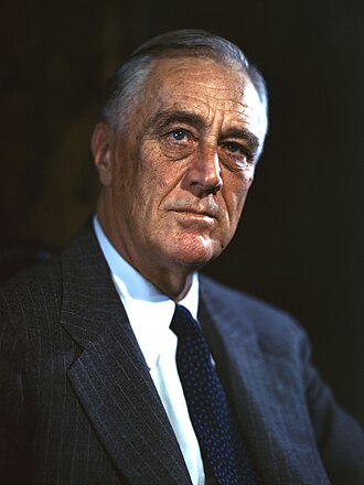 Franklin D. Roosevelt
Post-Graduate Legal • 1m
EO 8979 Dec 16, 1941
⚖️✨ Zone 2 (Zone of Twilight) Constitutional Neutral
Executive Order 8979—Establishing the Kenai National Moose Range
📜 Art. II §1: Executive Discretion & Internal Operations
For the purpose of protecting the natural breeding and feeding range of the giant Kenai moose on the Kenai Peninsula, Alaska, which in this area presents a unique wildlife feature and an unusual opportunity for the study in its natural environment of the practical management of…
Franklin D. Roosevelt Post-Graduate Legal • 4m
EO 8982 Dec 17, 1941
⚖️✨ Zone 2 (Zone of Twilight) Constitutional Neutral
Executive Order 8982—Changing the Name of the Economic Defense Board, Established by Executive Order No. 8839 of July 30, 1941, to the Board of Economic Warfare
📜 Art. II §2: Commander-in-Chief Supervisory Authority
The name of the Economic Defense Board, established by Executive Order No. 8839 of July 30, 1941, is changed to the Board of Economic Warfare. 2.
Franklin D. Roosevelt Grade 7 • 1m
EO 8981 Dec 17, 1941
⚖️✨ Zone 2 (Zone of Twilight) Constitutional Neutral
Executive Order 8981—Navy Hospital Area, Coco Solo, Canal Zone
📜 Art. II §2: Commander-in-Chief Supervisory Authority
Setting apart of reservation; boundaries. The following- described area of land in the Canal Zone is hereby reserved and set apart as, and assigned to the uses and purposes of, a naval reservation, which shall be known as Navy Hospital Area, Coco Solo, and which shall be under…
Franklin D. Roosevelt High School • 3m
EO 8989 Dec 18, 1941
⚖️✨ Zone 2 (Zone of Twilight) Constitutional Neutral
Executive Order 8989—Establishing the Office of Defense Transportation in the Executive Office of the President and Defining Its Functions and Duties
📜 Art. II §2: Commander-in-Chief Supervisory Authority
The term "domestic transportation" whenever used in this Order shall include railroad, motor, inland waterway, pipe line, air transport, and coastwise and intercoastal shipping. 2.
Franklin D. Roosevelt Post-Graduate Legal • 6m
EO 8984 Dec 18, 1941
⚖️✨ Zone 2 (Zone of Twilight) Constitutional Neutral
Executive Order 8984—Prescribing the Duties of the Commander in Chief of the United States Fleet and the Co-operative Duties of the Chief of Naval Operations
📜 Art. II §2: Commander-in-Chief Supervisory Authority
The Commander in Chief, United States Fleet, shall have supreme command of the operating forces comprising the several fleets of the United States Navy and the operating forces of the naval coastal frontier commands, and shall be directly responsible, under the general…
Franklin D. Roosevelt Post-Graduate Legal • 2m
📜
Scholarly & Legal Citations
Exec. Order No. 8978 (Dec. 16, 1941), https://executiveordersarchive.org/orders/app-executive-order-8978-establishing-new-york-harbor-new-london-delaware-bay-and-river.
